Construction progress
Consistent site captures that document progress, improve communication and create a visual project record.
Repeatable aerial data for construction, earthworks and property planning—delivered as clear maps, models and progress records.
TerraSkies supports contractors, developers, municipalities and property owners with efficient aerial capture and practical site intelligence.
Consistent site captures that document progress, improve communication and create a visual project record.
Detailed surface models and volume measurements for material tracking, planning and reporting.
High-resolution, measurable overhead maps for site context, logistics and informed field decisions.
Detailed digital representations of terrain, structures and shorelines for planning and visualization.
Selected mapping work that demonstrates how aerial imagery becomes a clear, detailed record of real-world sites.
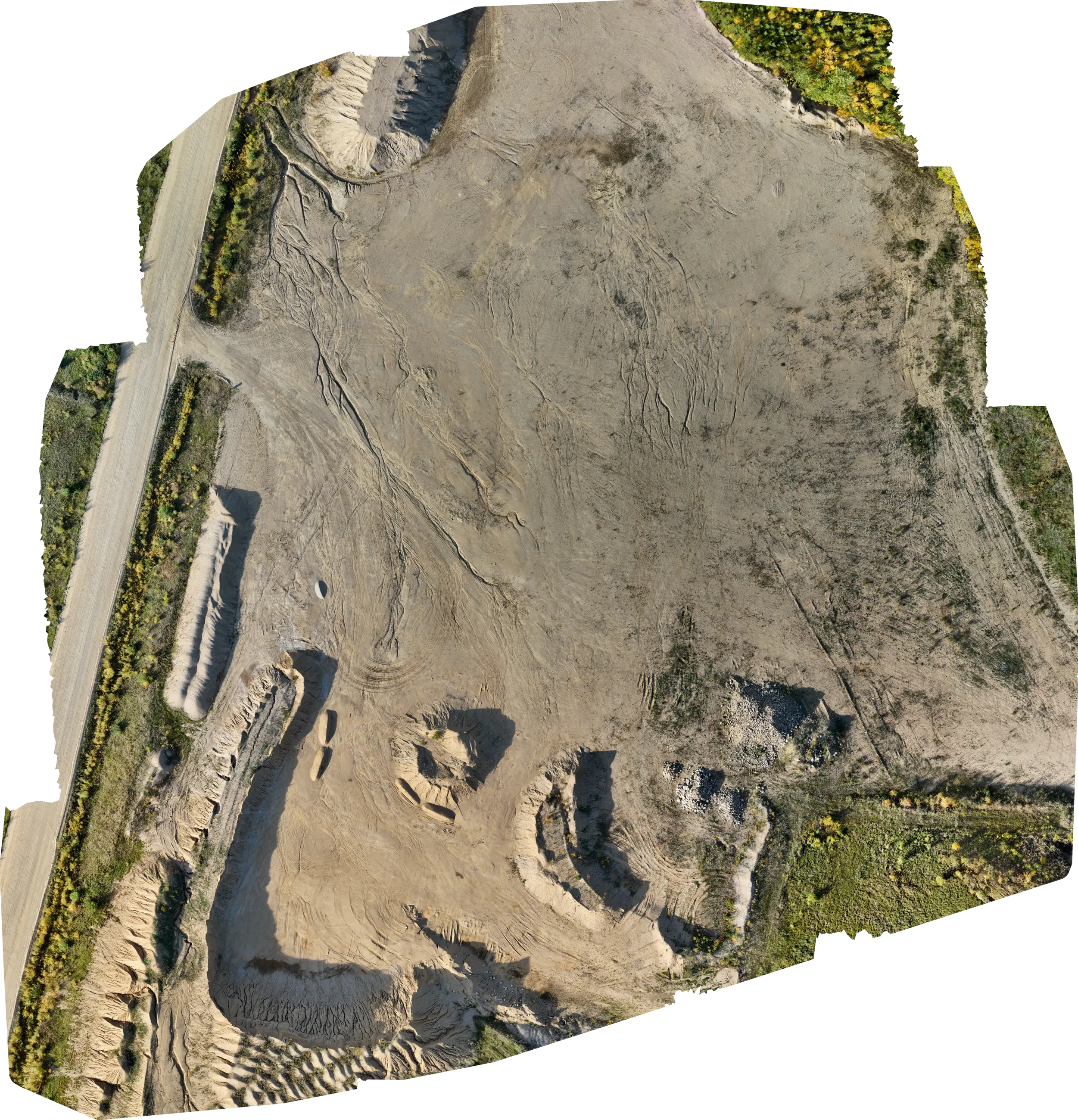
A professional demonstration of aerial site mapping and orthomosaic processing. Individual drone photographs were aligned and combined into one continuous overhead view, creating a practical visual record of the gravel pit, access routes and surrounding terrain. This project demonstrates the type of aerial mapping and site-documentation work TerraSkies is developing.
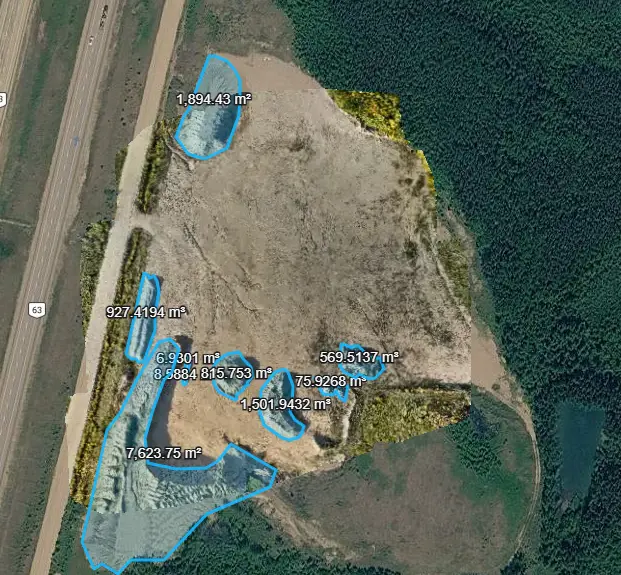
Photogrammetric surface modelling was used to calculate estimated material volumes from individually outlined stockpile areas.
Combined measured volume: approximately 13,424.65 m³
Photogrammetric volume estimates from a demonstration project — not survey-grade quantities.
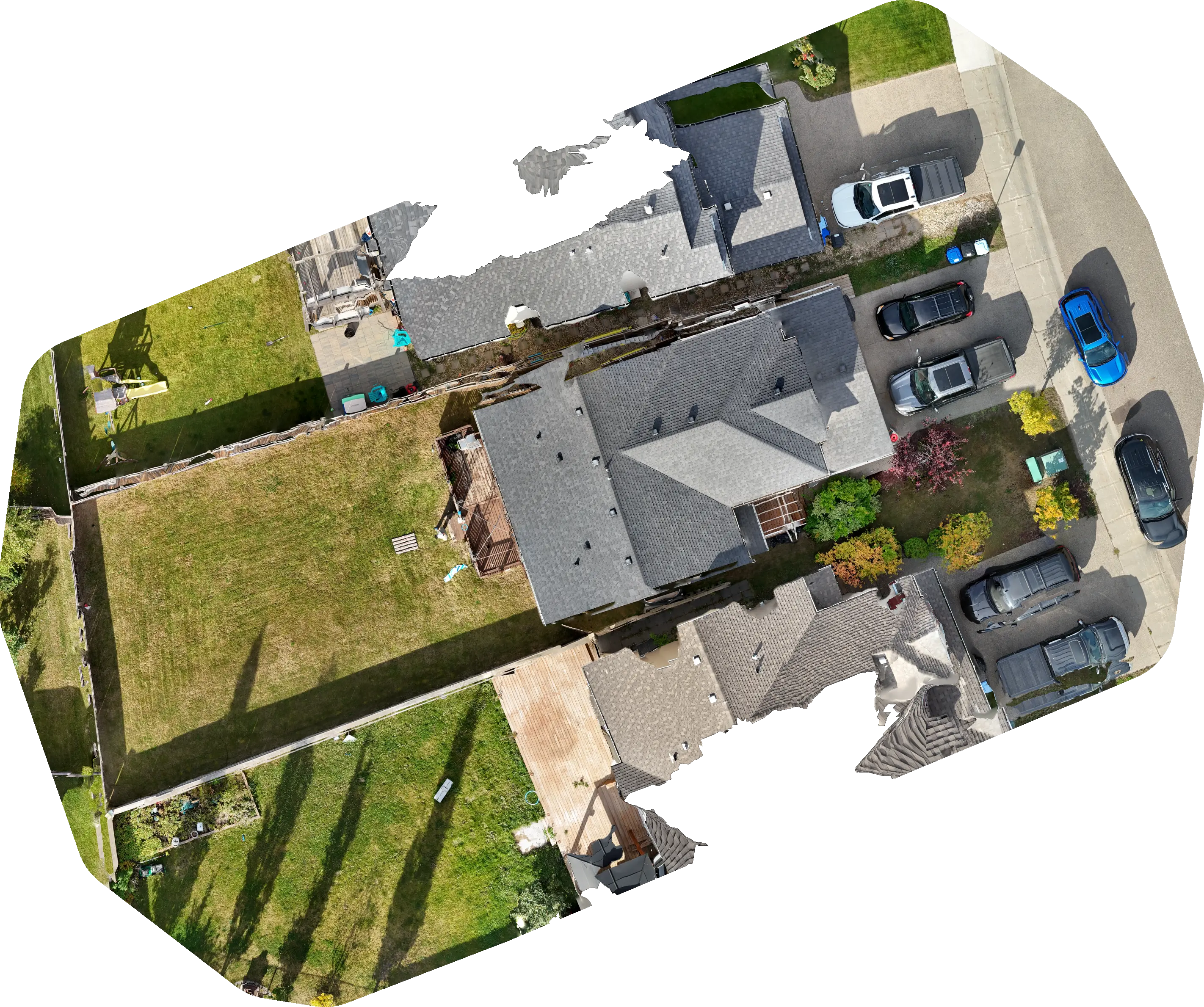
A professional residential aerial-mapping demonstration using drone imagery and orthomosaic processing to create a clear overhead view of the property and its existing conditions. The result illustrates how aerial site visualization can support property planning, landscaping, construction planning and project documentation.
The goal is not simply to fly a drone. It is to capture the right data, process it carefully and deliver information your team can act on.
Confirm the site, decision and accuracy requirements before mobilization.
Plan and fly a repeatable mission with safety and consistency at the centre.
Process the imagery into clear maps, measurements, models and reports.
From active earthworks to rugged coastal properties, TerraSkies is being built to provide responsive aerial mapping services across the province.
Tell us what you need to measure, document or understand.