Aerial overview
A georeferenced orthophoto for reviewing access, working areas and visible material footprints.
An aerial mapping showcase for earthworks: see the site, trace material footprints and explore documented volume estimates.
Location: Highway 63, Alberta | Source capture: October 1, 2026 | Service: Earthworks and stockpile mapping
Switch between imagery, elevation and 3D. Mark points, trace areas or create an elevation profile. For a stockpile estimate, define its footprint and enter a base elevation.
Tap a numbered pile for its estimated volume. Try a haul-route measurement, compare higher and lower surfaces, or start a 3D orbit.
Open full map ↗Choose a tool, then plot points on the map. Use Undo last point or Redo to fix a mistake, drag points to reshape a boundary, and tap the first point or Close polygon to finish an area. Save measurement stores it in this browser; export JSON to keep or restore a copy. Use Clear drawing to start over; it asks before clearing. Select 3D surface to rotate the DSM, or Show elevation for the coloured layer. Surface heights include vegetation and structures. Stockpile volume requires a user-defined horizontal base elevation; results are estimates and report missing coverage.
The revised footprints below were confirmed by the project owner. Volumes were calculated above an inferred sloping ground surface fitted to surrounding DSM elevations.
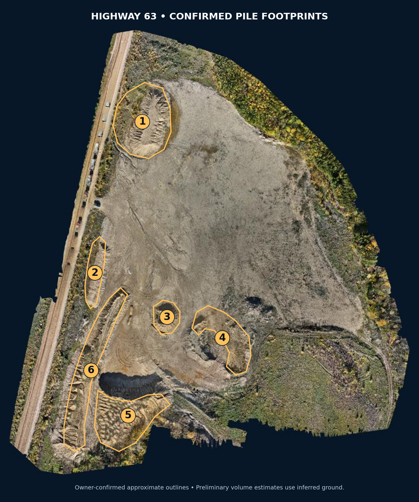
| Pile | Estimated volume |
|---|---|
| 1 | 5,420 m³ |
| 2 | 700 m³ |
| 3 | 810 m³ |
| 4 | 310 m³ |
| 5 | 3,650 m³ |
| 6 | 3,510 m³ |
| Combined estimate | ≈14,400 m³ |
Preliminary estimates, not verified inventory quantities. The ground beneath the piles was inferred rather than surveyed. Piles 5 and 6 are particularly uncertain because adjacent terrain does not fit a single plane well. Changing the surrounding ground sampling band from 1 m to 5 m changed pile 5 from about 3,490 to 4,290 m³ and pile 6 from about 3,130 to 4,410 m³; these comparisons are not confidence intervals. See the method notes before using the figures.
A georeferenced orthophoto for reviewing access, working areas and visible material footprints.
A DSM, interactive 3D surface and elevation profiles to inspect changes across the site.
Named GPS points, horizontal distances and areas, plus volume estimates with documented bases and coverage.
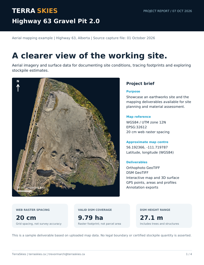
The four-page report brings together the aerial overview, DSM section, confirmed pile outlines and six-pile volume estimates, with their ground assumptions and limitations.
Download the project reportVolume estimates use DSM cells inside your boundary and a horizontal base elevation you define. The published six-pile estimates use confirmed approximate footprints and inferred sloping ground. The interactive drawing tool uses a horizontal base you enter. Neither establishes certified quantities. Actual project scope, accuracy requirements and deliverables are agreed before capture.